Mapping Energy: Young People Reimagining Power Beneath the City
Mapping Energy is part of Square Mile Churches: For a Sustainable Future, a project exploring how historic churches in the City of London can help lead the way toward a greener, more sustainable future.
Over the past year, the Mapping Energy project has brought together around 100 Year 12 students and early-career engineers to take on a fascinating challenge: how can we harness energy from beneath our streets to help heat and power some of the City’s oldest churches?
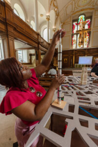
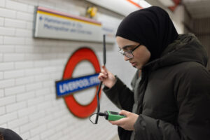
As part of the project, students visited companies already using excess heat from the Underground, tapping into deep boreholes or underground water sources to warm buildings in innovative ways. They measured temperatures in tube stations and compared them with the air above ground. From there, they developed creative ideas for transferring heat into nearby churches and worked out notional piping routes and energy flows.
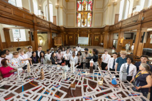
To bring their ideas to life, they created models of City churches and energy systems, all positioned on a large 3D map of London that shows how these historic buildings could one day be linked to clean energy sources right beneath them. Their work is thoughtful, imaginative, and firmly rooted in real science and engineering.
The map, along with a display of posters showing their research and designs, is now on view at The Green Skills Hub, The Flēot, from Tuesday 24th June. Some of the students and young engineers will also be sharing their findings through short presentations, a chance to hear directly from the next generation of problem-solvers.
We’re incre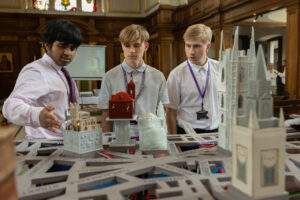 dibly grateful to the students, teachers, engineers and church communities who brought so much enthusiasm and insight to this project. Special thanks also go to the National Lottery Heritage Fund and the Royal Academy of Engineering’s Ingenious Award, whose generous support made this work possible. This is a powerful example of what can happen when heritage, science, and creativity come together — and we hope it’s just the beginning.
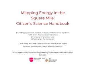
Mapping Energy in the Square Mile – Citizen’s Science Handbook
With the global energy market making a decisive move towards net zero carbon, England’s energy transition has become a topic of national debate. The International Energy Agency estimates that the shift to Net Zero will result in the loss of 13 million jobs in fossil fuel industries, but the creation of 30 million new jobs to support the transition.
London’s Square Mile, home to St Bartholomew’s Hospital, St Paul’s Cathedral, and 38 remarkable churches designed by architects such as Sir Christopher Wren, Nicholas Hawksmoor, and George Dance the Younger, is a place where history and innovation meet. Protecting these architectural treasures while making them more sustainable is central to building a greener future for the City.
Our short handbook, Mapping Energy in the Square Mile: Citizen’s Science Handbook, invites you to explore London’s past energy transitions and discover the new technologies driving today’s move to Net Zero. It offers practical steps for understanding and mapping energy use in historic churches, helping to identify opportunities for efficiency improvements without compromising heritage value.
Download the handbook here: Mapping Energy NTU Student Handbook FINAL LD
Mapping Energy: Final Day Highlights
We’re excited to share a special video capturing the final day of the Mapping Energy Project, a celebration of collaboration, innovation, and community impact.
In this film, Archdeacon of Charing Cross, Katherine Hedderly, interviews students and engineers who played a vital role in the project. They reflect on their experiences, the challenges they overcame, and the future of sustainable energy in the City.
The video also features The Bishop of London, Sarah Mullaly, offering her insights on the importance of partnerships between faith, education, and engineering in shaping a greener future.
🎥 Watch the full video here: City churches mapping energy project on Vimeo

